


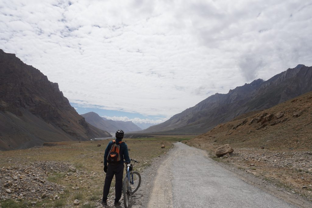


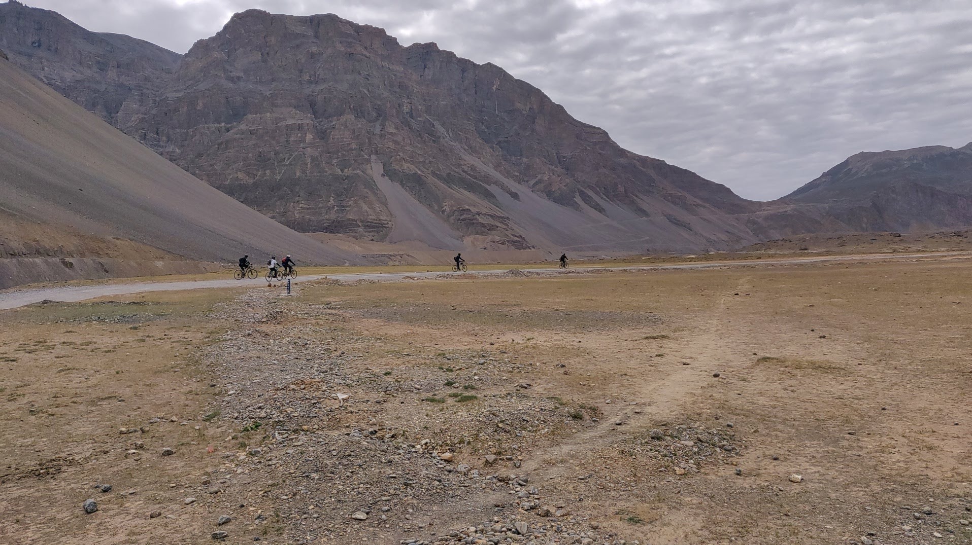


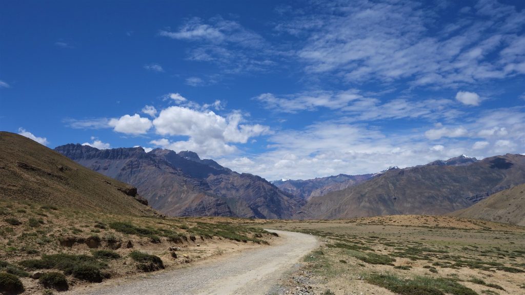


The Zanskar Cycle tour is a 500 Kms – 12 day expedition that will transport you through the awe-inspiring landscapes, diverse topography, and rich cultural tapestry of the Zanskar region. This tour will take you from Manali, over the Rohtang Pass and into the Lahaul valley along the Chandra river and onward over the Shingo La Pass to reach the mythical Kingdom of Zanskar and onward to Kargil. The route is a mix of tarmac and rough un-metalled roads with beautiful views throughout. Biking through some of the remotest parts of Himachal and Ladakh, this trip provides a myriad of experiences. Zanskar is a valley from another time. The remoteness of the region allows few modern amenities . Ancient monasteries dot the brown valleys, interspersed with green villages – it’s the High Himalayas at their best. We end the trip in well connected Kargil town from where you can choose to either make your way to Srinagar or Leh.
The participants arrive in Manali. Take the day to get acclimatised with your bike and for last minute preparations.
Today we will do a gear check and last minute preparations.
We will do a ride to Solang valley to ensure we are all set for the long expedition. As the day winds down you can choose to go visit the hot water springs for a dip at Vashisht or Kalath. Overnight at Hotel.
The journey starts from the smooth roads of Manali. We take a series of hairpin bends to leave the Pine and Deodar forests surrounding Manali, cycle through the villages of Palchan, Kothi and Gulaba to reach the alpine meadows at Marhi – the base of the Rohtang Pass. Camp here for the night.
Cumulative Elevation Gain: 1600 m, Loss: 200 m
We start the day with a steep climb to the top of Rohtang Pass at nearly 4000m. The descent from the pass is the beginning of the mix of metalled and unmetalled roads. We follow the Chandra river here to reach the camping grounds at Sissu.
Cumulative Elevation Gain: 1600 m, Loss: 200 m
Today we cycle through Keylong – the biggest city in Lahaul and Tandi – the confluence of the Chandra and Bhaga rivers to form Chandrabhaga river which later becomes the Chenab. The gradient is low most of the day today. Camp at Jispa on the banks of the river.
Cumulative Elevation Gain: 1600 m, Loss: 200 m
We cycle today on mostly flat terrain until we reach Darcha. We leave the main Manali Leh Highway to make our way to Zanskar Sumdo on a gradually ascending trail.
Cumulative Elevation Gain: 1600 m, Loss: 200 m
Pass day today. We start early today and make our way on unmetalled roads with sparse vegetation. The ascent is steep but the view from the pass is spectacular. Make our way down to reach Lakhang by the evening.
Cumulative Elevation Gain: 1600 m, Loss: 200 m
Make our way today to the first Zanskari villages we see enroute. We pass Gumburonjon (5900m), a huge rock face revered by the locals. Pass Kargiakh, Kuru and Testa village to camp at Purne at the riverside.
Cumulative Elevation Gain: 1600 m, Loss: 200 m
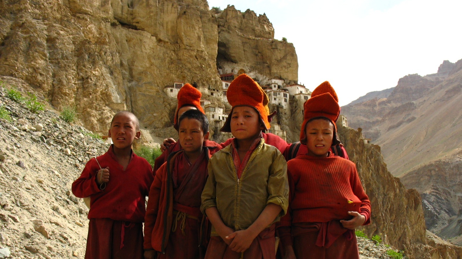
We take a side trip today to the picturesque Phuktal Gompa (3850m), one of the most spectacular sights in Zanskar. This monastery dates back to the early 12th century and is built in a cave. Return to camp at Purne.
We leave behind the isolation and make our way to the bigger Zanskari villages of Ichar and Mune to reach the capital of the erstwhile Zanskar kingdom – Padum. Padum is a small town now with shops and cafes and most modern amenities.
Cumulative Elevation Gain: 1600 m, Loss: 200 m
We leave Padum to cycle to the base of the Pensi La. The road, although wide, can be littered with big potholes. Even though this is the only fully motorable road that connects Zanskar to the rest of the world, cars on the route are infrequent. We camp next to the road for the night.
Cumulative Elevation Gain: 1600 m, Loss: 200 m
Covering a larger distance today. We start the day with the uphill climb to Pensi La and cycle down to the valley floor of the Suru River. A very scenic ride takes us through Rangdum and Parkachik villages and onward to Tangol.
Cumulative Elevation Gain: 1600 m, Loss: 200 m
Our Last day of cycling today. Cycle through Balti settlements and Panikhar town to reach Kargil town by the evening. Trip Ends!
Cumulative Elevation Gain: 1600 m, Loss: 200 m
Clothing:
– Good quality waterproof jacket
– Waterproof trousers
– Balaclava (thick fleece)
– Sun hat
– Cycle mitts
– Warm gloves – mountaineering gloves (waterproof outer, fleece inner) are good.
– Mid-weight fleece top
– Cycling tights (looser, “trackster” fit rather skin-tight lycra),
– Shorts
– Long sleeved shirt
– Travel trousers
– 2 wicking tee-shirts (synthetic or merino wool)
– Cotton tee-shirt for around town
– Long sleeved thermal top
– Thermal long johns
– 2-3 pairs underwear
– 2-3 pairs of standard socks
– 1 pair warm sock
Footwear:
– Cycling shoes, e.g. SPD’s, if applicable (bring spare cleats)
– Trekking shoes and climbing shoes
– Flip-flops, Crocs or Sandals to wear around camp.
Pack:
– Main bag – soft shell duffle bag to be kept in the logistics vehicle.
– Day Pack 15 – 20 lts – You will use this to carry your camera, water bottle, Trail layers, trail food etc.
Accessories:
– A bike helmet
– Dark glasses (the sun is very strong),
– Camera
– Toiletries – Sunscreen SPF 40+, Moisturizer, Lip balm, Soap, Toilet paper
– Repair Kit (needle and thread).
– Headlamp/ Torch.
– Water Bottle- Ideally keep two bottles 1 litre each.
– Plastic Packing covers.
Documents:
– A couple of spare passport photos photocopies of key documents. e.g., passport (data and visa pages),
– Travel insurance policy
The Zanskar Cycle tour is a 500 Kms – 12 day expedition that will transport you through the awe-inspiring landscapes, diverse topography, and rich cultural tapestry of the Zanskar region. This tour will take you from Manali, over the Rohtang Pass and into the Lahaul valley along the Chandra river and onward over the Shingo La Pass to reach the mythical Kingdom of Zanskar and onward to Kargil. The route is a mix of tarmac and rough un-metalled roads with beautiful views throughout. Biking through some of the remotest parts of Himachal and Ladakh, this trip provides a myriad of experiences. Zanskar is a valley from another time. The remoteness of the region allows few modern amenities . Ancient monasteries dot the brown valleys, interspersed with green villages – it’s the High Himalayas at their best. We end the trip in well connected Kargil town from where you can choose to either make your way to Srinagar or Leh.
The participants arrive in Manali. Take the day to get acclimatised with your bike and for last minute preparations.
Today we will do a gear check and last minute preparations.
We will do a ride to Solang valley to ensure we are all set for the long expedition. As the day winds down you can choose to go visit the hot water springs for a dip at Vashisht or Kalath. Overnight at Hotel.
The journey starts from the smooth roads of Manali. We take a series of hairpin bends to leave the Pine and Deodar forests surrounding Manali, cycle through the villages of Palchan, Kothi and Gulaba to reach the alpine meadows at Marhi – the base of the Rohtang Pass. Camp here for the night.
Cumulative Elevation Gain: 1600 m, Loss: 200 m
We start the day with a steep climb to the top of Rohtang Pass at nearly 4000m. The descent from the pass is the beginning of the mix of metalled and unmetalled roads. We follow the Chandra river here to reach the camping grounds at Sissu.
Cumulative Elevation Gain: 1600 m, Loss: 200 m
Today we cycle through Keylong – the biggest city in Lahaul and Tandi – the confluence of the Chandra and Bhaga rivers to form Chandrabhaga river which later becomes the Chenab. The gradient is low most of the day today. Camp at Jispa on the banks of the river.
Cumulative Elevation Gain: 1600 m, Loss: 200 m
We cycle today on mostly flat terrain until we reach Darcha. We leave the main Manali Leh Highway to make our way to Zanskar Sumdo on a gradually ascending trail.
Cumulative Elevation Gain: 1600 m, Loss: 200 m
Pass day today. We start early today and make our way on unmetalled roads with sparse vegetation. The ascent is steep but the view from the pass is spectacular. Make our way down to reach Lakhang by the evening.
Cumulative Elevation Gain: 1600 m, Loss: 200 m
Make our way today to the first Zanskari villages we see enroute. We pass Gumburonjon (5900m), a huge rock face revered by the locals. Pass Kargiakh, Kuru and Testa village to camp at Purne at the riverside.
Cumulative Elevation Gain: 1600 m, Loss: 200 m
We take a side trip today to the picturesque Phuktal Gompa (3850m), one of the most spectacular sights in Zanskar. This monastery dates back to the early 12th century and is built in a cave. Return to camp at Purne.
We leave behind the isolation and make our way to the bigger Zanskari villages of Ichar and Mune to reach the capital of the erstwhile Zanskar kingdom – Padum. Padum is a small town now with shops and cafes and most modern amenities.
Cumulative Elevation Gain: 1600 m, Loss: 200 m
We leave Padum to cycle to the base of the Pensi La. The road, although wide, can be littered with big potholes. Even though this is the only fully motorable road that connects Zanskar to the rest of the world, cars on the route are infrequent. We camp next to the road for the night.
Cumulative Elevation Gain: 1600 m, Loss: 200 m
Covering a larger distance today. We start the day with the uphill climb to Pensi La and cycle down to the valley floor of the Suru River. A very scenic ride takes us through Rangdum and Parkachik villages and onward to Tangol.
Cumulative Elevation Gain: 1600 m, Loss: 200 m
Our Last day of cycling today. Cycle through Balti settlements and Panikhar town to reach Kargil town by the evening. Trip Ends!
Cumulative Elevation Gain: 1600 m, Loss: 200 m
Clothing:
– Good quality waterproof jacket
– Waterproof trousers
– Balaclava (thick fleece)
– Sun hat
– Cycle mitts
– Warm gloves – mountaineering gloves (waterproof outer, fleece inner) are good.
– Mid-weight fleece top
– Cycling tights (looser, “trackster” fit rather skin-tight lycra),
– Shorts
– Long sleeved shirt
– Travel trousers
– 2 wicking tee-shirts (synthetic or merino wool)
– Cotton tee-shirt for around town
– Long sleeved thermal top
– Thermal long johns
– 2-3 pairs underwear
– 2-3 pairs of standard socks
– 1 pair warm sock
Footwear:
– Cycling shoes, e.g. SPD’s, if applicable (bring spare cleats)
– Trekking shoes and climbing shoes
– Flip-flops, Crocs or Sandals to wear around camp.
Pack:
– Main bag – soft shell duffle bag to be kept in the logistics vehicle.
– Day Pack 15 – 20 lts – You will use this to carry your camera, water bottle, Trail layers, trail food etc.
Accessories:
– A bike helmet
– Dark glasses (the sun is very strong),
– Camera
– Toiletries – Sunscreen SPF 40+, Moisturizer, Lip balm, Soap, Toilet paper
– Repair Kit (needle and thread).
– Headlamp/ Torch.
– Water Bottle- Ideally keep two bottles 1 litre each.
– Plastic Packing covers.
Documents:
– A couple of spare passport photos photocopies of key documents. e.g., passport (data and visa pages),
– Travel insurance policy